
Psalter World Map (detail), c.1265
London, British Library, Additional MS 28681, f.9r
Image here via https://commons.wikimedia.org/wiki/File:Psalter_World_Map,_c.1265.jpg
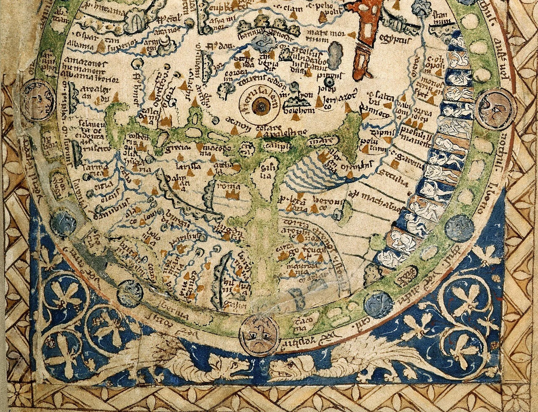
To most people, the term mappa mundi describes a particular – and rather peculiar - relic of the middle ages: a supposed map of the world, dating to around 1300, and today residing in Hereford Cathedral. This remarkable survival has a tendency to both enthral and appal the modern viewer. For all the love and care and attention to detail, it is also a most bewilderingly inaccurate depiction of the world – at least to modern eyes.
It is in fact a T-O, or Isidorean map, so called because it represents the African, European, and Asian landmass as a circle, divided into three parts by a T-shaped combination of the Mediterranean, the River Don, and the River Nile. It was never intended as a navigational tool. It is rather an artistic expression of God’s earth, as well as a source of information about the world, its peoples, and creatures. It is also not alone. There are dozens of mappi mundi from all over Europe, and there are several different types: zonal, or Macrobian maps, tripartite (or T-O), Beatus (or quadripartite), and Complex maps. The latter draw closer to the “accuracy” we expect from a map today, and we will explore in particular the captivating Ebstorf Map, before finishing with perhaps the greatest achievement of medieval cartography: the Venetian Fra Mauro Map.
Warning: There may be dragons!
RJW F2619 Online (via Zoom)
A 5-hour short course, delivered via 2 x 2½-hour sessions on consecutive Saturdays (Saturday 6 & Saturday 13 June).
£40 (individual registration); £72 (for two people sharing one screen).